New BGU System Detects Global Palm Tree Infestation
New BGU System Detects Global Palm Tree Infestation
June 1, 2021 - Summarized from Arizona Jewish Life
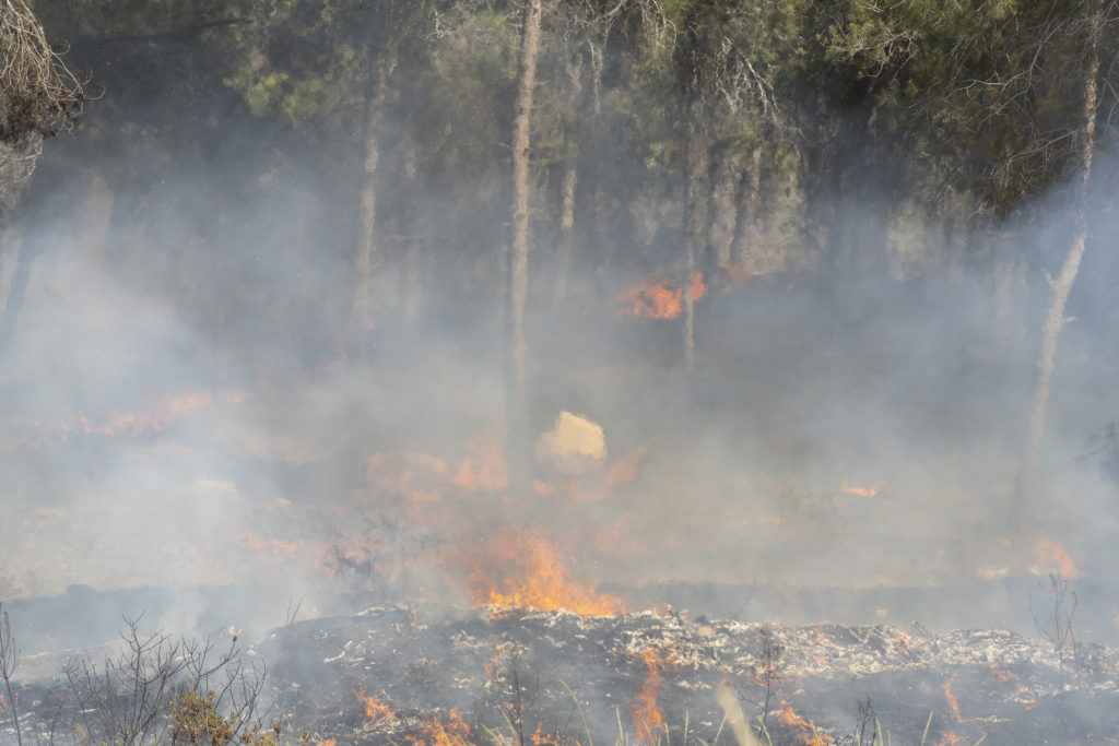
Arizona Jewish Life – While the spread of weevils has become an existential threat for palm trees around the world, a team of Ben-Gurion University (BGU) researchers has developed a new global monitoring system for automatic palm tree infestation.
Fighting a Palmdemic
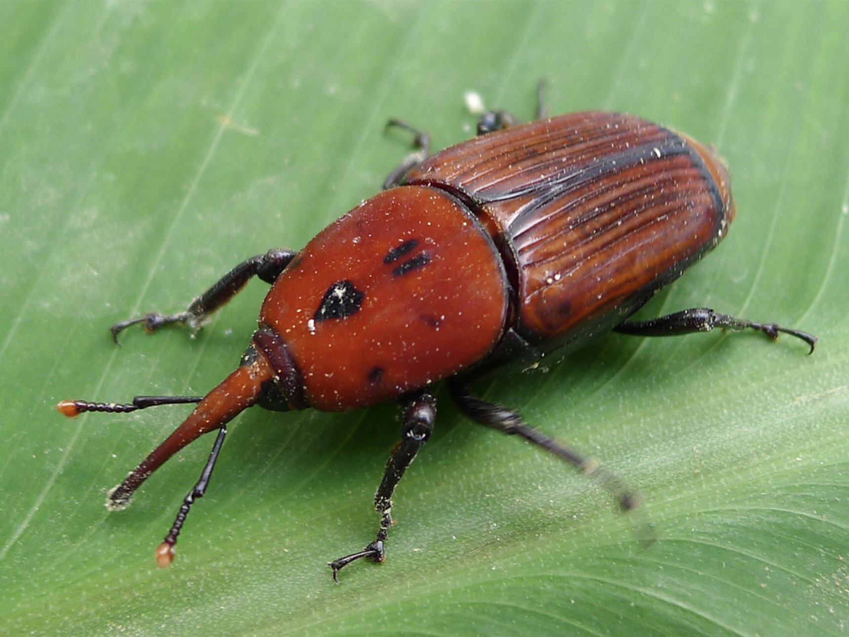
The Red Palm Weevil
The Red Palm Weevil, a type of beetle, lays its eggs inside the palm tree and its larvae feeds on the palm’s tissue, causing extensive damage, and even breakage.
Early detection of the damaging pest infestation is critical to homeowners and palm growers since the beetles can travel up to 30 miles (50 kilometers) a day.
By combining state-of-the-art deep learning methods with Google aerial and street view images of palm trees, BGU researchers were able to demonstrate how to geolocate an infested tree and examine the severity of damage, both in urban and suburban areas.
“Municipalities, and departments of agriculture around the world could all greatly benefit from such a remarkable innovation by BGU researchers,” says Doug Seserman, chief executive officer of Americans for Ben-Gurion University.
Detecting Infested Palm Trees Using Data Science
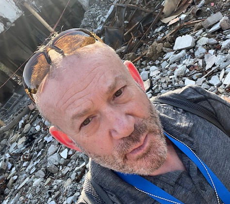
Dr. Michael Fire, BGU Department of Software and Information Systems Engineering
The method, which was tested in San Diego, Miami-Dade County, and in Israel could revolutionize current outdated practices for Red Palm Weevil management, with more effective and less expensive monitoring.
To date, the sole method of determining whether weevils have infested a tree has been a visual and acoustic assessment of individual trees, which is laborious, time consuming and impractical for large-scale municipal monitoring.
The research was inspired by Dr. Michael Fire of the BGU Department of Software and Information Systems Engineering and head of the Data4Good Lab. “Our method can be instantly deployed to any scale of need and every geographic location where street view level imagery is accessible,” explains Dr. Fire.
Read more at Arizona Jewish Life >>
Stories Like This